Sea Ice Minimum and Maximum in the Arctic

Credits: Sea ice concentration calculated at the University of Bremen from 89 GHz data of the AMSR2 sensor on the GCOM-W1 satellite; background: "Blue Marbleā€ MODIS data from the NASA Earth Observatory; 1981-2010 sea ice contour from NSIDC: National Snow and Ice Data Center.

The extent of sea ice in the Arctic shows a strong seasonal cycle: in March the sea ice area reaches its largest and in September its smallest extent. During recent years the sea ice extent has reduced significantly compared to the long-term median of the 20 years 1981 to 2010.

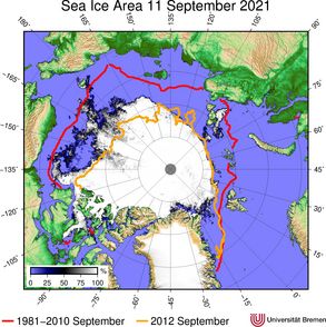
In September 2021 the twelfth lowest sea ice extend in the satellite record was observed. The 2021 September ice extend was high compared to the last years but still much lower than the long-term average. 

Arctic Sea Ice Minima

2021 minimum sea-ice area from AMSR2 compared to historic summer ice extents: In red the 30-year September median for 1981-2010 and in orange the lowest minimum in 2012.
2021 Arctic Sea Ice Minimum
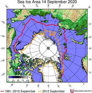
2020 minimum sea-ice area from AMSR2 compared to historic summer ice extents: In red the 30-year September median for 1981-2010 and in orange the lowest minimum in 2012.
2020 Arctic Sea Ice Minimum
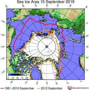
2019 minimum sea-ice area from AMSR2 compared to historic summer ice extents: In red the 30-year September median for 1981-2010 and in orange the lowest minimum in 2012.
2019 Arctic Sea Ice Minimum.
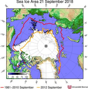
2018 minimum sea-ice area from AMSR2 compared to historic summer ice extents: In red the 30-year September median for 1981-2010 and in orange the lowest minimum in 2012.
2018 Arctic Minimum.
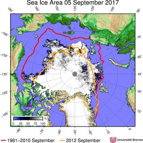
2017 minimum sea-ice area from AMSR2 compared to historic summer ice extents: In red the 30-year September median for 1981-2010 and in orange the lowest minimum in 2012.
2017 Arctic Minimum
2016 minimum sea-ice area from AMSR2 compared to historic summer ice extents: In red the 30 year September mean for 1981-2010 and in orange the lowest minimum in 2012. The 2016 minimum was the second lowest on record.
2016 Arctic Minimum
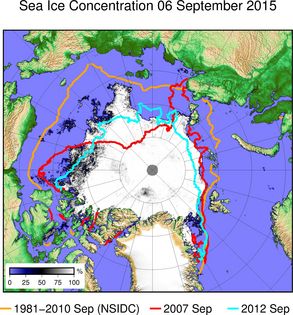
2015 minimum sea-ice area from AMSR2 compared to historic summer ice extents: In orange the 30-year September mean for 1981-2010, in cyan the lowest minimum in 2012 and in red the 2007 minimum.
2015 Arctic Minimum
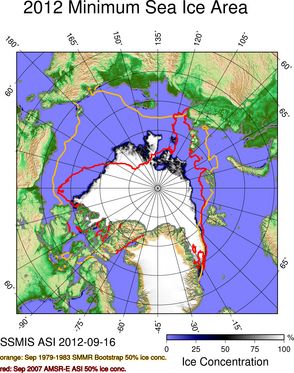
2012 minimum sea-ice area from SSMIS, the lowest sea-ice extent on record, in comparison to September 2007 (red) and September 1979-1983 (orange) sea-ice extents.
2012 Arctic Minimum
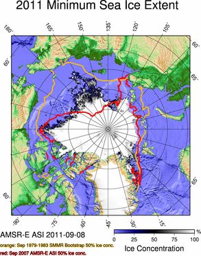
2011 minimum sea-ice area from AMSR-E in comparison to September 2007 (red) and September 1979-1983 (orange) sea-ice extents.
2011 Arctic Minimum
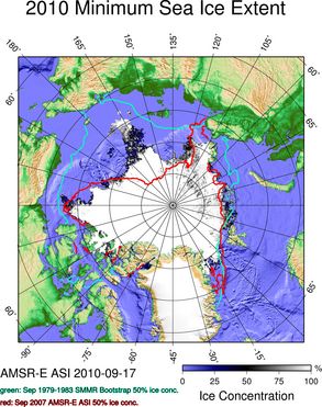
2010 minimum sea-ice area from AMSR-E in comparison to September 2007 (red) and September 1979-1983 (green) sea-ice extents.
2010 Arctic Minimum
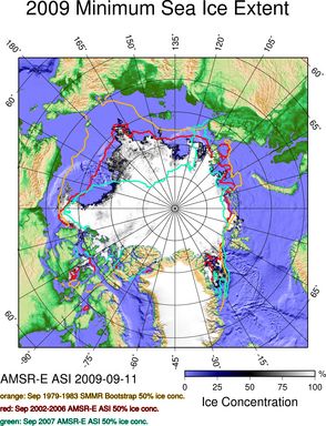
2009 minimum sea-ice area from AMSR-E in comparison to previous sea-ice extents.
2009 Arctic Minimum
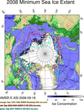
2008 minimum sea-ice area from AMSR-E in comparison to previous sea-ice extents.
2008 Arctic Minimum
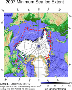
2007 minimum sea-ice area from AMSR-E, the lowest sea-ice extent on record at that time, in comparison to previous sea-ice extents.
2007 Arctic Minimum
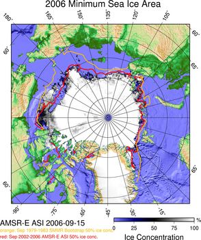
2006 minimum sea-ice area from AMSR-E in comparison to previous sea-ice extents.
2006 Arctic Minimum
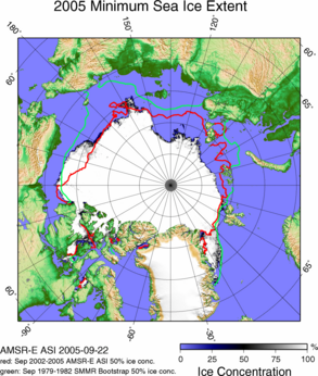
2005 minimum sea-ice area from AMSR-E, the lowest sea-ice extent on record at that time, in comparison to previous sea-ice extents.
2005 Arctic Minimum
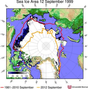
1999 minimum sea-ice area from SSM/I compared to todays summer ice extents: In red the 30-year September median for 1981-2010 and in orange the lowest minimum in 2012.
1999 Arctic Minimum


Data archive, citation and contact

Data archive

All data can be found in the Data Archive. To quickly browse the dataset, please have a look at the Data Browser.

How to cite

Please help maintaining this service by properly citing and acknowledging if you use the data for publications:
Spreen, G., L. Kaleschke, and G.Heygster (2008), Sea ice remote sensing using AMSR-E 89 GHz channels J. Geophys. Res.,vol. 113, C02S03, doi:10.1029/2005JC003384.

The data from years 2002-2018 are also available at the data publisher PANGAEA, one data set each for Arctic and Antarctic, AMSR-E-based and AMSR2-based:

Melsheimer, Christian, Spreen, Gunnar (2020): AMSR-E ASI sea ice concentration data, Arctic, version 5.4 (NetCDF) (June 2002 - September 2011). PANGAEA, https://doi.pangaea.de/10.1594/PANGAEA.919777 

Melsheimer, Christian; Spreen, Gunnar (2020): AMSR-E ASI sea ice concentration data, Antarctic, version 5.4 (NetCDF) (June 2002 - September 2011). PANGAEA, https://doi.pangaea.de/10.1594/PANGAEA.919778

Melsheimer, Christian; Spreen, Gunnar (2019): AMSR2 ASI sea ice concentration data, Arctic, version 5.4 (NetCDF) (July 2012 - December 2018). PANGAEA, https://doi.org/10.1594/PANGAEA.898399

Melsheimer, Christian; Spreen, Gunnar (2019): AMSR2 ASI sea ice concentration data, Antarctic, version 5.4 (NetCDF) (July 2012 - December 2018). PANGAEA, https://doi.org/10.1594/PANGAEA.898400 

Contact

For questions regarding the data please contact Gunnar SpreenChristian Melsheimer, or Georg Heygster.
For questions related to the website and data-browser please contact Malte Gerken.

Institute of Environmental Physics, University of Bremen, Germany.