Intermittent service disruptions from Feb 23 until March 13
Because of infrastructure works on which we have no influence, there will be several service disruptions between Monday, 23 February and Friday, 13 March. The exact timing is not fixed yet,
The disruptions can last from a few hours up to several days. During these times, this webpage will still be online, but without access to the data archive, and without daily updates. We will try to process missed data between service disruptions, whenever services are back.
We regret the inconvenience.
Winter snow depth on Arctic sea ice from AMSR-E/2
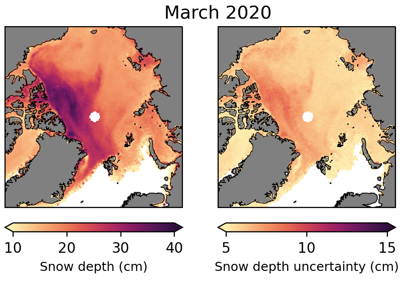
This dataset contains daily winter snow depth on Arctic sea ice (version 1.1) from AMSR-E/2 on a polar stereographic grid (25km2). Snow depth is available from November - April over Arctic first year ice and March - April over Arctic first year and multiyear ice. Data is available from November 2002 - Now (monthly updated).
Included are:
- Daily arrays of Arctic snow depth
- Daily arrays of Arctic snow depth uncertainty
Snow depth on Arctic sea ice
 |
Algorithm
The algorithm development is described in detail in Rostosky et al., 2018. Snow depth is derived from passive microwave satellite observations from the AMSR-E/2 sensor for the period from 2002 to now. The data is available on a daily basis gridded to polar stereographic grid with 25 x 25 km spatial resolution. Over first-year ice, snow depth is derived from November to April and over multiyear ice from March to April.
The algorithm is based on a empirical linear relation between the gradient ratio from brightness temperature at 18.7 GHz and 6.9 GHz (vertical polarization) and the snow depth. The empirical linear relation is derived from a comparison between the satellite observations and airborne snow depth observations from the OperationIceBridge campaign (Newmann et al., 2014). More details are described in Rostosky et al., 2018.
A condense description of the product is available in the user guide: https://data.seaice.uni-bremen.de/SnowDepth/Arctic/n25000/Product_description.pdf
How to cite
Please help maintaining this service by properly citing and acknowledging if you use the data for publications:
Rostosky, P., G. Spreen, S.L. Farrell, T. Frost, G. Heygster, and C. Melsheimer (2018). Snow Depth Retrieval on Arctic Sea Ice From Passive Microwave Radiometers—Improvements and Extensions to Multiyear Ice Using Lower Frequencies, Journal of Geophysical Research: Oceans, 123, doi.org/10.1029/2018JC014028
Data Access
All data can be found in the Data Archive and be accessed by http here: https://data.seaice.uni-bremen.de/SnowDepth/.
Contact
For more details on the snow depth on sea ice data, please contact Gunnar Spreen.


 Start
Start